How to Read a Property Survey on Long Island
A property survey is one of the first documents to review before planning an addition, deck, pool, fence or major renovation. It shows the parcel and visible improvements, but a line on the drawing is not permission to build. Here is a practical way to read it.
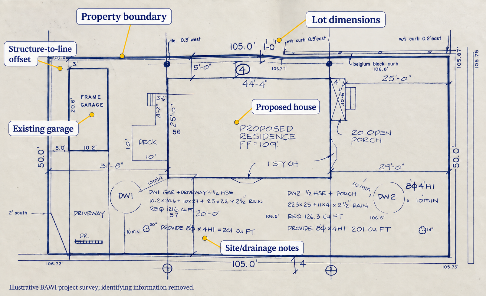
An annotated BAWI project survey/site plan. Identifying project information has been removed.
Confirm the property, survey date and purpose
Start with the title block. Check the property address, owner or client name, surveyor, license number, survey date and any revisions. Then read the notes and certification.
Make sure the survey reflects the current site. If a garage, deck, shed, pool or addition is missing, the drawing may predate that work. Also confirm what kind of survey was prepared. A tax map or online parcel map is useful for research, but it is not a boundary survey.
Find the boundary lines and street frontage
The heavier outside lines usually identify the parcel boundary. Each side may include a distance and a bearing, which gives the line’s direction. Look for the north arrow, scale and corner markers or monuments.
Do not measure a scan with a ruler and assume the result is exact. Use the written dimensions. If the survey and physical site appear to disagree, ask a licensed land surveyor to review the condition.
Read the buildings and improvements
Next, locate the house and other visible improvements, such as garages, porches, decks, sheds, pools, fences, driveways and retaining walls. Surveys often show offset dimensions from a structure to a property line.
Those dimensions help an architect compare existing conditions with zoning rules. They do not prove that every item was permitted or complies with today’s setbacks. Municipal records, including permits and certificates of occupancy, still need to be checked.
Look carefully at easements and encroachments
An easement gives another party a limited right to use part of the property, often for utilities, access or drainage. It may appear as a labeled strip or dashed line, but symbols vary. Read the survey legend and notes instead of relying on line style alone.
The survey may reference a recorded document by liber and page or another filing number. The drawing can indicate where an easement is located; the recorded document explains the rights and restrictions.
Also look for fences, walls, pavement or structures that cross a boundary. These may be labeled as encroachments or shown with dimensions that reveal the issue.
Compare the survey with zoning and municipal records
A survey records physical and boundary information. Zoning determines where construction may be allowed. Setback lines are not shown on every survey, and the applicable setbacks depend on the zoning district, lot history and proposed work.
Before designing, BAWI compares the survey with current zoning and the municipal property file. Our guide to zoning analysis explains that next step.
If you are planning work, BAWI can help organize the survey, property records and proposed drawings through our Permits, Legalizations & Approvals services. You can also view our residential projects or contact BAWI to discuss a specific property.